所在地 台東区東上野6-18 (源空寺墓地)
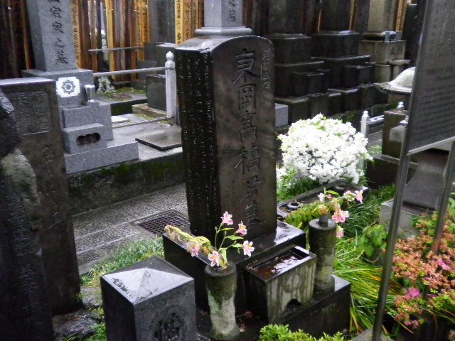
角石の墓碑正面に、「東岡高橋君之墓」と隷書で刻み、三面には、尾藤二州の撰文を刻む。東岡は至時の号である。
至時は江戸時代中期の暦学者。明和元年(1764)11月、大坂御蔵番同心、高橋元亮の子として生まる。名を至時、字を子春、通称を作左衛門といい、東岡または梅軒と号した。15歳で父の職を継ぐ。性来、数学・暦学を好み、公務のかたわら、それらの研究に励む。ついで、当時の天文学会の第一人者、麻田剛立の門に入って学ぶ。
寛政7年(1795)、改暦の議が幕府で起きると、師剛立の推挙で、同門の間重富とともに天文方に抜擢され、寛政9年(1797)「寛政暦」をつくる。一方、伊能忠敬が幕命により、実測地図を作成する際には、測量を指導し、完成させた。その関係で、二人は後世「日本地図の父母」といわれている。文化元年(1804)1月5日、41歳で肺患のため没した。著書に『赤道日食法』等がある。
平成7年(1995)3月 台東区教育委員会
TOMB OF TAKAHASHI YOSHITOKI
(National Historical Site)
Takahashi Yoshitoki was born in Osaka in 1764 and became a famous astronomer in the latter half of the 18th century.He was appointed to "TENMONGATA" of the Shogunate Government at Edo,which was apost supervising astronomy,calendar making,and land surveying.He was the central fugure in a calendar improvement project initiated as the time.He guided Ino Tadataka in surbeying and assisted in producing a map of Japan using actual surveys.They were later known as the forefathers of Japanise map-making.Takahashi died at the age of 41 in 1804.
PR


